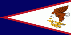
Vatia (Vatia)
Vatia is a village on Tutuila Island in American Samoa. It is a north shore village located on Vatia Bay. The road to Vatia, American Samoa Highway 006, is the only road going through National Park of American Samoa. Vatia is a scenic community at the foot of Pola Ridge and surrounded by the national park. It is only reached by Route 6 which traverses the national park before reaching Vatia. There was once a hiking trail over Maugaloa Ridge from Leloaloa, but since the completion of Route 6, this trail is now overgrown. It is home to a beach, and panoramic views of jungle-covered peaks surround the village on all sides. Vatia is the center of the Tutuila-section of National Park of American Samoa. It is located in Vaifanua County.
Vatia is home to several concrete bunkers from World War II located on and around the beach. The scenic road between Vatia and Afono is lined with gardens of ornamental plants and flowers. At the end of the road in Vatia is the school, and beyond the school begins a trail leading into the national park. It ends at a rocky cliff which points across Vai'ava Strait to Pola Island. Many Vatians work at the canneries in Pago Pago, and there is good public transportation to and from Pago Pago. Aiga buses from Fagatogo head to Vatia several times per day on weekdays. The village of Vatia can also be visited by hiking Mount ‘Alava.
Vatia is one of the oldest settlements on Tutuila Island and it has historically been regarded as the principal place of eastern Tutuila. Vatia dwells around Vatia Bay which is protected and surrounded by green forested mountains and rich coastal reefs on its seafront.
Vatia Bay has been described as Tutuila Island's most scenic area. A steep ridge curves around the village's west side and leads to Pola Island, which has been claimed to be the most photographed site on Tutuila Island. Pola Island is the most popular attraction in the village.
Vatia literally translates to “between the tombs of those with paramount status.”
Map - Vatia (Vatia)
Map
Country - American_Samoa
 |
 |
American Samoa consists of five main islands and two coral atolls; the largest and most populous island is Tutuila, with the Manuʻa Islands, Rose Atoll and Swains Island also included in the territory. All islands except for Swains Island are part of the Samoan Islands, The total land area is 199 sqkm, slightly more than Washington, D.C. As of 2022, the population of American Samoa is approximately 45,443 people, of whom the vast majority are indigenous ethnic Samoans. Most American Samoans are bilingual and can speak English and Samoan fluently.
Currency / Language
| ISO | Currency | Symbol | Significant figures |
|---|---|---|---|
| USD | United States dollar | $ | 2 |
| ISO | Language |
|---|---|
| EN | English language |
| SM | Samoan language |
| TO | Tongan language |


